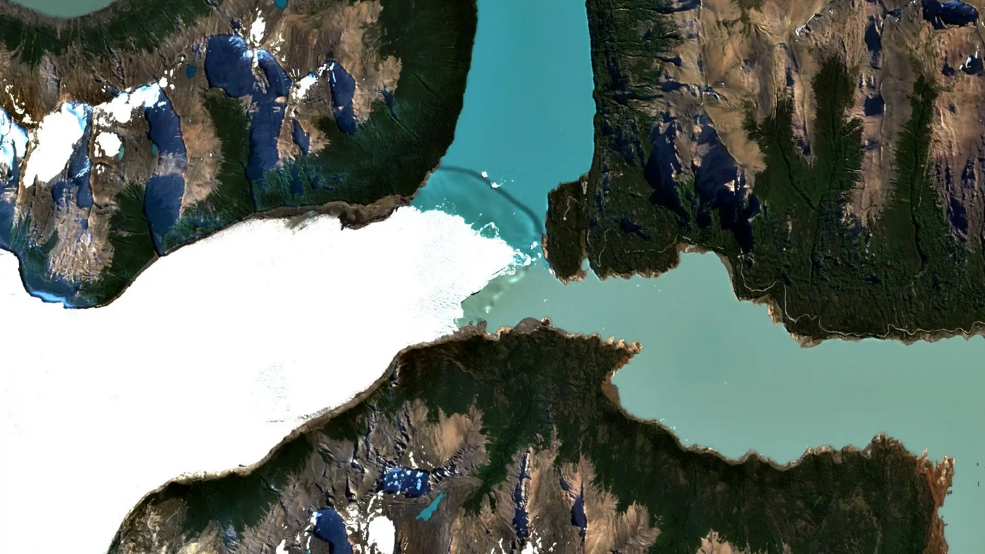
Glaciers store water for months or years and release it downstream. When they change, the effects reach rivers, reservoirs, farmland and towns far from the ice. For insurers and lenders with exposure to water supply, hydropower or flood-prone land, satellite imagery is a practical way to watch the source. The scene above shows the Perito Moreno Glacier meeting Lago Argentino in Patagonia [1].
Watching the ice
A glacier front moves, and the position of the terminus, the extent of the ice and the colour of the meltwater can all be followed in free Sentinel-2 imagery that repeats every few days [2]. Comparing images from different seasons and different years shows whether a glacier is advancing, retreating or thinning at its edge [3]. Sharper commercial imagery can show crevasses, calving fronts and the margins of glacial lakes in more detail.
Water supply and hydropower
Many rivers depend on glacier melt, especially in dry months [4]. A hydropower operator or the lender behind a dam needs to know whether the catchment above it is changing, because inflow shapes how much power a plant can produce. Imagery of the ice, of snow cover and of the level of reservoirs gives an independent check on conditions upstream.
Flood risk
Meltwater collects in lakes held back by ice or loose debris, and these can drain suddenly. Imagery can show lakes forming and growing [5], which helps insurers and lenders judge which valleys, roads and assets sit below them [6]. Radar from Sentinel-1 adds a view through cloud, which is common over mountains, and can help map surface water once a flood has begun [7].
Limits
Imagery shows the surface. It records where ice and water are and how that changes, and it does not by itself say how much water a glacier holds or when a lake might fail. Those judgements still need specialist analysis, with imagery as one input.
The imagery for this work can be searched across suppliers on Data Sphere. To see it for a site you follow, write to info@astrodynamic.space.
References
- European Space Agency. Earth from Space: Southern Patagonian Ice Field. ESA, 29 September 2023. https://www.esa.int/ESA_Multimedia/Images/2023/09/Earth_from_Space_Southern_Patagonian_Ice_Field
- European Space Agency. S2 Mission. SentiWiki, Copernicus Sentinel Online. https://sentiwiki.copernicus.eu/web/s2-mission
- Paul, F., Winsvold, S., Kääb, A., Nagler, T. and Schwaizer, G. Glacier Remote Sensing Using Sentinel-2. Part II: Mapping Glacier Extents and Surface Facies, and Comparison to Landsat 8. Remote Sensing, 8(7), 575, 2016. https://doi.org/10.3390/rs8070575
- Pritchard, H. D. Asia’s shrinking glaciers protect large populations from drought stress. Nature, 569, 649 to 654, 2019. https://doi.org/10.1038/s41586-019-1240-1
- Shugar, D. H. and others. Rapid worldwide growth of glacial lakes since 1990. Nature Climate Change, 10, 939 to 945, 2020. https://doi.org/10.1038/s41558-020-0855-4
- Taylor, C. and others. Glacial lake outburst floods threaten millions globally. Nature Communications, 14, 487, 2023. https://doi.org/10.1038/s41467-023-36033-x
- European Space Agency. Emergency response. ESA. https://www.esa.int/Applications/Observing_the_Earth/Copernicus/Sentinel-1/Emergency_response